
The Science of Slope Angles
Share this Post
The Delicate Science of Slope Angles
I have a very privileged position as an avalanche instructor. Not only am I lucky enough to be many people’s first guide into the backcountry, but I am constantly in a mindset that critically looks at decision-making systems and how to present those systems to my students in a way that is engaging and practical. As a result, I’m constantly reminded of the intricate dance between nature’s forces and human understanding, especially regarding the physics of slope angles and avalanche dynamics. Now, with that being said, let’s dive into the delicate science of slope angles.
The Mechanical Marvel: Avalanche Formation
At its core, an avalanche is a battle between gravity and friction. When a cohesive layer of snow perched precariously atop a slope succumbs to the relentless pull of gravity, it cascades downhill, transforming into a roaring mass of snow and debris. But what determines whether this precarious equilibrium will be disturbed?
This past week I was traveling in the backcountry walking on a large snowfield at the bottom of a wide, flat valley in the Colorado mountains. Suddenly, I heard a loud whumph and felt the football field-sized tract of snow sink under my feet. The energy of my movement penetrated the base of the snowpack made up of weak, uncohesive snow. That collapse zippered across the entirety of the snowpack via the top layer of firm and cohesive snow. In the span of a second 350,000 kg of snow collapsed to the valley floor. As I stood at the bottom of the valley, unharmed, I processed the immediate evidence of instability that the mountains provided. I was able to safely collect that evidence because one key piece of the avalanche puzzle was missing, slope angle.
Deciphering the Slope Angle Equation
Slope angle, measured in degrees, is a critical factor in avalanche dynamics. Picture this: a shallow slope, barely inclined, offers minimal resistance to the gravitational forces at play. In contrast, a steep slope, with its pronounced gradient, amplifies the pull of gravity, creating a veritable avalanche launchpad.
Understanding the science of slope angles is not merely an exercise in geometry; it’s a lesson in stability. A slope’s angle influences the stress distribution within the snowpack, determining whether it will hold firm or succumb to the irresistible urge to slide. Shallow slopes, with their gentler gradients, distribute stress more evenly, fostering stability. Conversely, steep slopes concentrate stress, increasing the likelihood of snowpack failure and avalanche initiation.
What is “Avalanche Terrain”?
There is a line you can cross between non-avalanche and avalanche terrain. Avalanche terrain is defined by a slope that is steep enough where, if the correct snowpack structure existed, moving snow would have the opportunity to gain velocity and momentum down a slope. This boundary happens somewhere between a horizontal and vertical slope. This line has been discussed in many snow science publications where different research groups were able to determine a slope angle where the weight of a snowpack will generally overcome the force of static friction and begin to move.
I am particularly drawn to Ian McCammon’s 2009 article in The Avalanche Review, where McCammon critically looks at older studies and inputs newer avalanche data to see if the patterns connecting slope angle and avalanches hold true. In this systematic review, the data shows that avalanche occurrence has variance based on the type of snowpack (continental, intermountain, and maritime) but avalanches are most common between the slope angles of 30 to 45 degrees with a most common occurrence at 38 degrees. That being said, the minimum slope angle needed to produce an avalanche is 25 degrees.
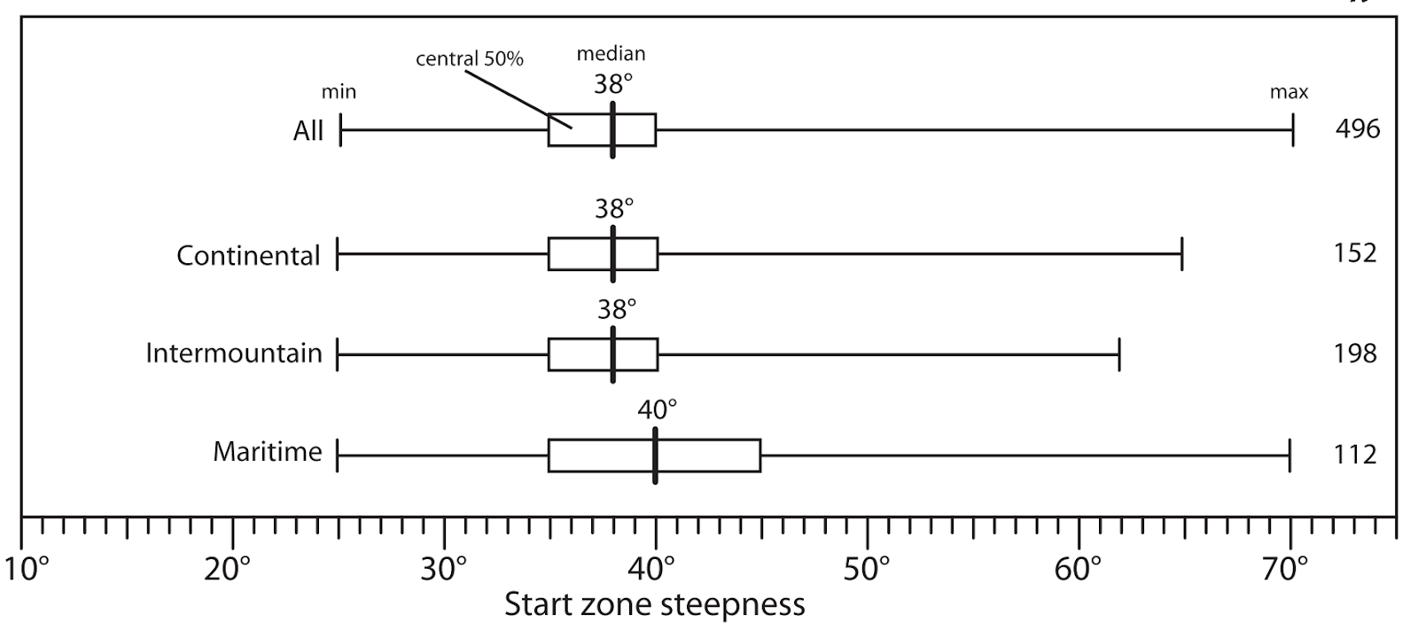
Figure 1: McCammon (2009), 38° Revisited: A Closer Look at Avalanche Types & Slope Angles, The Avalanche Review.
The hard and fast rule in Backcountry travel
As an AIARE instructor, I find myself saying “It depends” quite often as I field questions from my students. This can be met with frustration from students who desperately want some hard and fast rules when it comes to backcountry travel and avoiding avalanches. What result should I get on an Extended Column Test to ski a slope? Well, it depends. How much confidence do you have in assessing the spatial variability of the snowpack over a larger area? The only hard and fast rule that I feel comfortable giving is related to slope angle.
Based on the data, avalanches are non-existent below slope angles of 25 degrees and exceedingly rare below 30 degrees. As long as you can measure a slope angle with confidence, then you can accurately predict the likelihood of an avalanche in backcountry terrain. With the caveat that the observed terrain is not connected to steeper avalanche terrain.
Navigating the Avalanche Landscape
An outcome of an introductory avalanche class is to arm students with the confidence to use terrain as a tool in a decision-making matrix. With an understanding of the science of slope angles and their implications, backcountry enthusiasts can navigate terrain with greater confidence and awareness. By accurately assessing slope angles and their associated risks, adventurers can make informed decisions, choosing routes that minimize exposure to avalanche hazards. The question remains: in a world where a few degrees matter, what are some methods to reliably measure the angle of a slope?
Tools for measurement:
Throughout an avalanche course, I will allow my students to try out various methods of measuring slope angles and then have discussions about which are most practical, and sound in their methodology. There are three different kinds of slope angle measurements that a backcountry traveler will need to take and different tools are more adept at a certain kind of measurement.
- On Slope Measurements: I will often open up a Recreational Level 1 Course with a quick exercise in predicting slope angle. Standing on a variety of slopes, I will ask my students to make quick predictions on the respective slope angles. I will then quickly take out a clinometer and give immediate feedback on their predictions. The goal of this exercise is to communicate two ideas. One is that it can be very easy to take a slope angle measurement with the appropriate tools. The second is that, with enough practice, anyone can develop a pretty accurate search image to predict slope angles within a few degrees. Students will find that throughout a three-day course, their predictions will become more and more precise. Students will then pick up on a key flaw in this methodology. One needs to be standing on a slope to measure the steepness of the slope. If your goal for a ski tour is to avoid slopes above 25 degrees, then one would need another method of data collection in their toolbox.
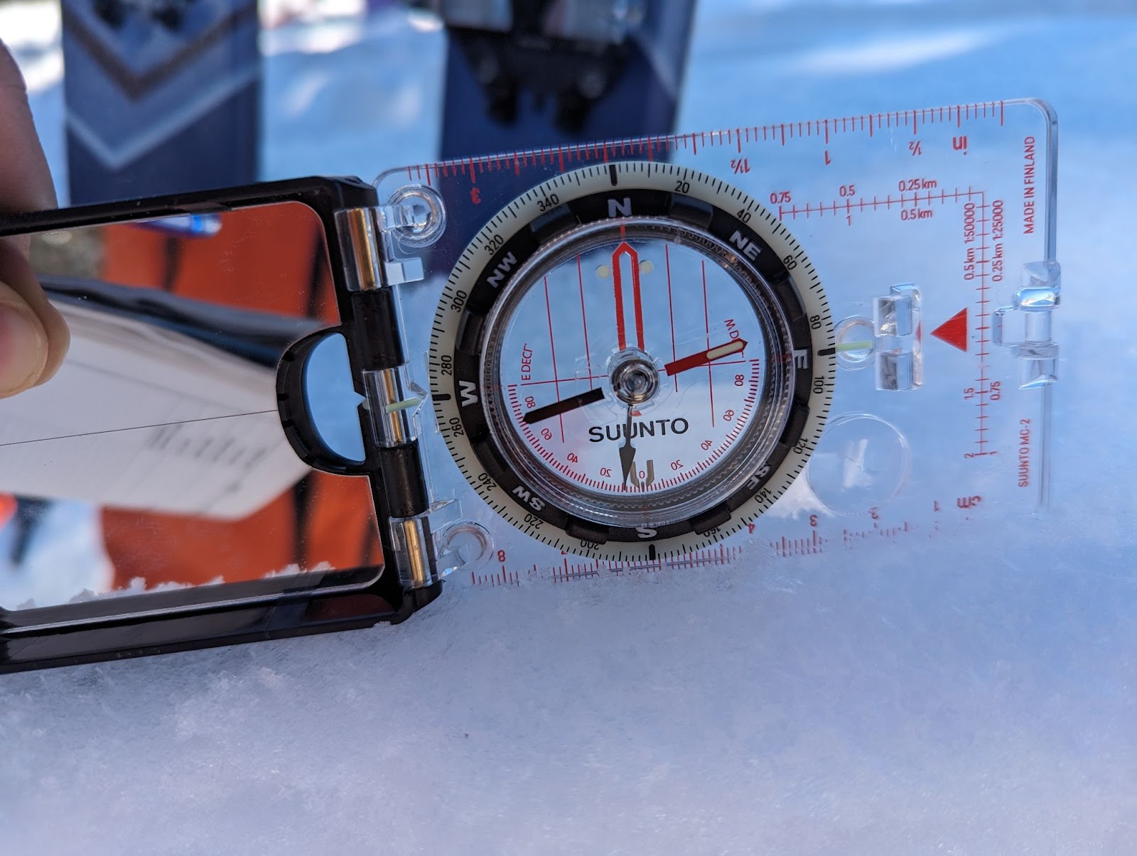
Figure 2: Using the clinometer built into a Suunto MC-2 compass, a quick and precise measurement of slope angle can be made in the field.
- Cross-slope measurements: In addition to making on-slope measurements, you will also need to gauge the angle of a slope from afar. If you have an opportunity to view the profile of a slope, You can use a clinometer and place the straight edge in line with the horizon line to gauge the average angle of that slope. This method will also come with limitations, it will be challenging to measure the small fluctuations in slope angle from a distance. Wind-drifted snow and micro terrain features will create small pockets of steeper or shallower features within larger terrain. These small terrain features have caught people off-guard before and have produced avalanches in otherwise benign terrain.
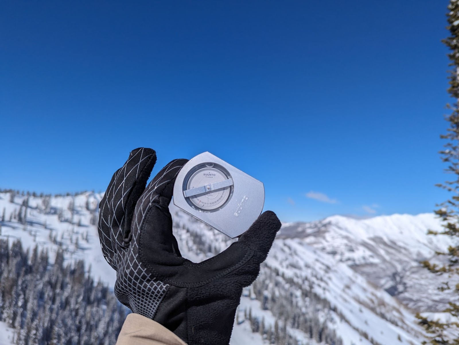
Figure 3: Using a Suunto PM-5 Clinometer, you can align the straight edge of the tool to determine the angle of a slope from a distance. This specialist tool is designed for forestry and can be a pricy tool to use for recreational use.
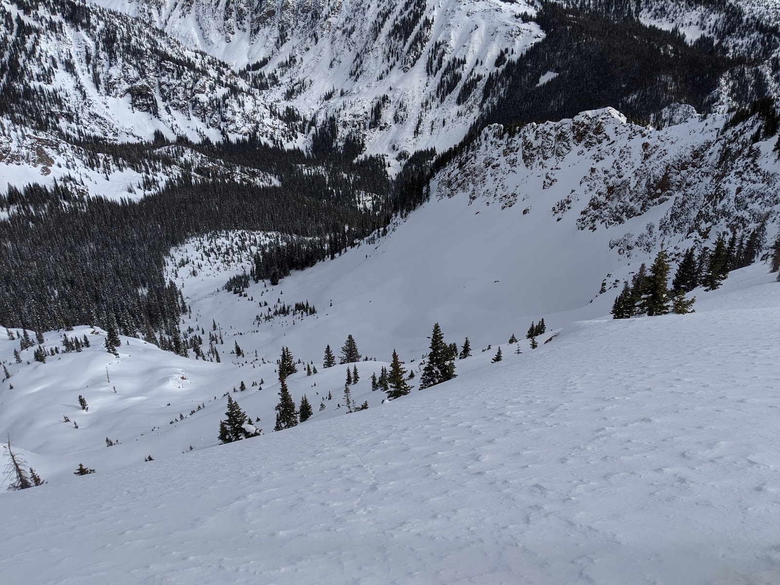
Figure 4: A slope is rarely continuous in its slope angle. Micro terrain features can provide a challenge for backcountry skiers to navigate terrain.
- Up/down slope measurements: Standing above or below a slope, you may need some data to determine if you want to interact with that slope based on the avalanche forecast for a given day. A trickier measurement to take, but I have found that using a clinometer with a dedicated sighting tool is indispensable. My personal favorites are the Suunto PM-5 Clinometer and the Suunto MC-2 G Mirror Compass.
 | 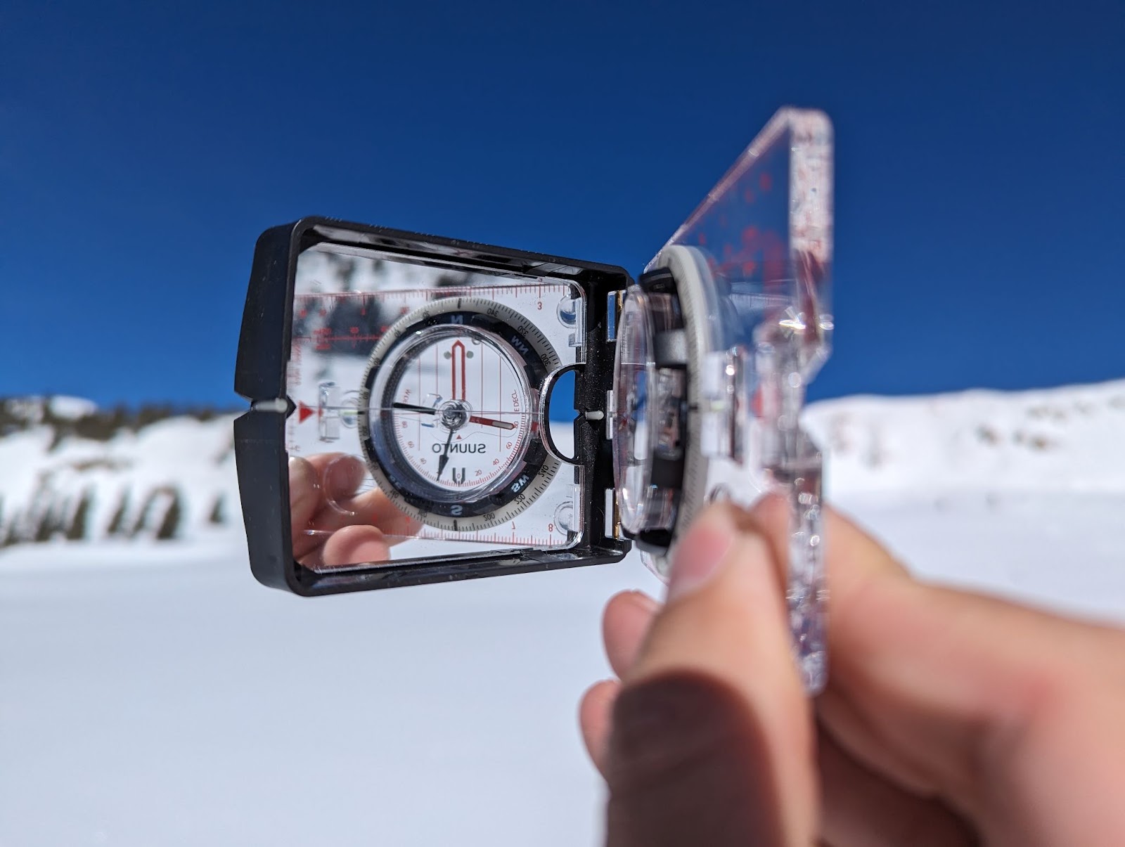 |
Figure 5: A Suunto PM-5 Clinometer and the Suunto MC-2 G Mirror Compass are tools that can provide slope angle measurements in all three contexts, on-slope, cross slope, and up/down slope.
Slope angle shading
Even with all of these tools in your back pocket, they still only provide single data points. You can compile all of those data points to get a more complete assessment of the avalanche terrain in a given area, but you can also do some of that work ahead of time. Using slope angle shading on platforms like Caltopo can be incredibly beneficial for identifying avalanche terrain for several reasons:
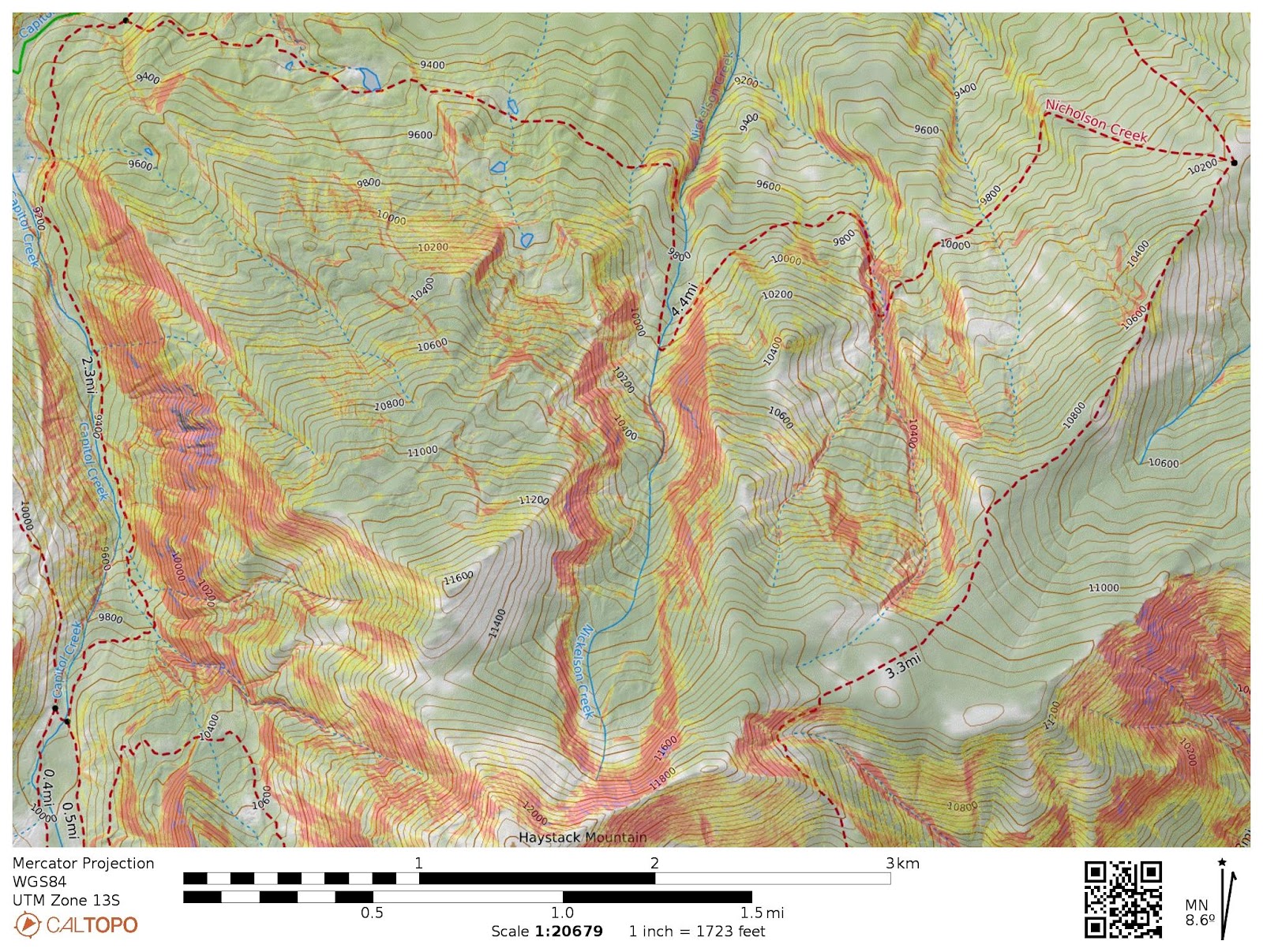
Figure 6: Cal-Topo’s slope angle shading tool can give a very clear picture of changes in slope angle across a variety of terrain.
Slope angle shading provides a visual representation of terrain steepness, allowing users to quickly identify areas with slopes that are prone to avalanches. Steeper slopes that are generally more prone to avalanches are color-coded, giving users an efficient way to visualize avalanche terrain in different areas. Additionally, by overlaying slope angle shading on a map, users can analyze the terrain and identify features such as convexities, gullies, and other terrain traps that can compound existing avalanche risk. This analysis helps users make informed decisions about route planning and terrain selection, avoiding high-risk areas.
Mapping Software Limitations
Mapping software has its limitations, however. The topography of the terrain changes in the wintertime. Slopes that may fall below the necessary 25-degree threshold to be considered avalanche terrain in the summer, may become steeper as the snowfall and wind sculpt terrain features that may not be picked up by mapping software. It could also be the case where satellite data may not be able to accurately reflect the nuances of point-specific topography changes. A 2019 case study in the Upper Senator Beck Basin exemplifies the limitations of mapping software.
Six skiers part of a Level 2 Avalanche course made a trip plan (figure 7a) intending to avoid slopes over 30 degrees. Pouring over mapping software, they saw an opportunity to thread the needle and navigate complex terrain by taking a small corridor of snow below 30 degrees amid steeper slopes.
Comparing their map to another map using a more sophisticated data set revealed that their planned route was more nuanced and complex than initially believed. While this case study does not factor in the fact that the intended route is still connected to avalanche terrain regardless of the slope angle directly below the track, it can exemplify the discrepancy between models and data that can be collected in the field.
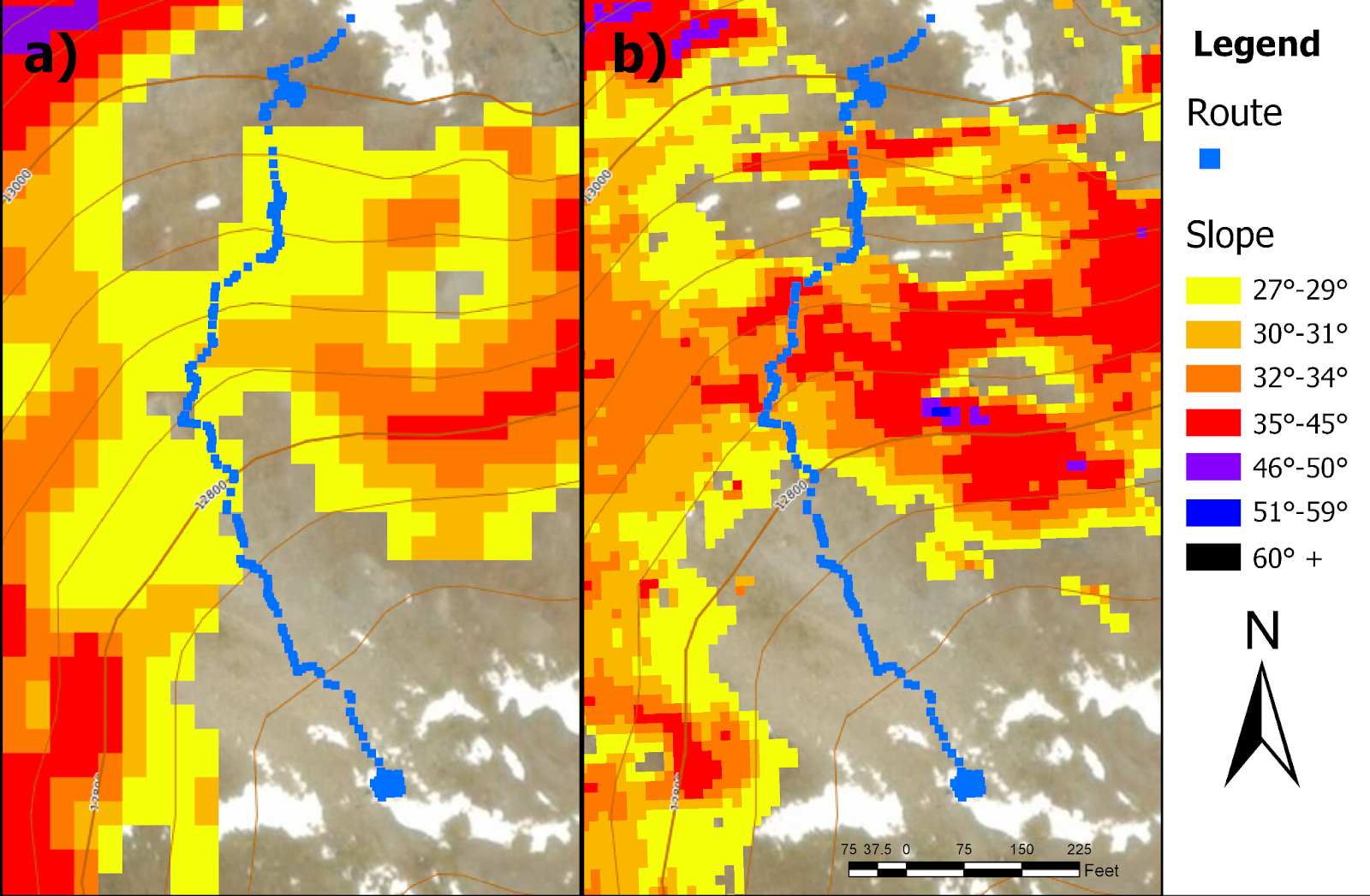
Figure 7: Courtesy of the Colorado Avalanche Information Center. “A comparison of slope angle from two different digital elevation models a) 10m DEM for the National Elevation Dataset with fixed slope angle shading from Caltopo b) 3m DEM from LiDar survey on September 26th, 2016 with similar color gradations.”
Despite some limitations, mapping software like Caltopo is indispensable for trip planning. Before heading into the backcountry, slope angle shading can aid in trip planning by highlighting areas of concern and allowing users to plan safer routes. Slope angle shading serves as a valuable tool for assessing avalanche risk levels. By combining slope angle information with other factors provided by a robust avalanche forecast (such as snowpack stability, weather conditions, and recent avalanche activity) users can more accurately assess the overall risk level of a given area.
This is where I think all of these tools tie together. Trip planning is done at home, and data collection and verification with a diverse set of tools is done in the field. Using slope angle shading on platforms like Caltopo enhances safety by providing visual information about terrain steepness, that informs decision-making in the field.
Where the Science of Slope Angles Meets Adventure
In the realm of avalanche dynamics, slope angle serves as a fundamental parameter, shaping the very contours of risk and adventure. By unraveling the physics behind slope angles, we gain insight into the delicate balance between stability and chaos that defines the avalanche landscape. It can feel like there is an overwhelming amount of information that one needs to take into consideration to recreate in the backcountry safely, but it can come down to one variable, slope angle.
Some of my most treasured days in the backcountry were on slopes below 30 degrees. A majority of skiing done on-piste is below 30 degrees. I have colleagues and friends who have spent their entire careers in the backcountry only skiing on non-avalanche terrain. As the winter season unfolds, It can feel as if there is a lot of pressure to push into avalanche terrain even if conditions don’t perfectly align. Conditions will eventually align for a patient and observant skier.
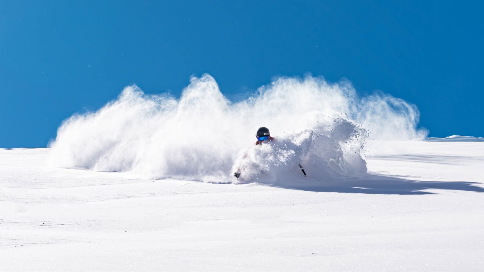
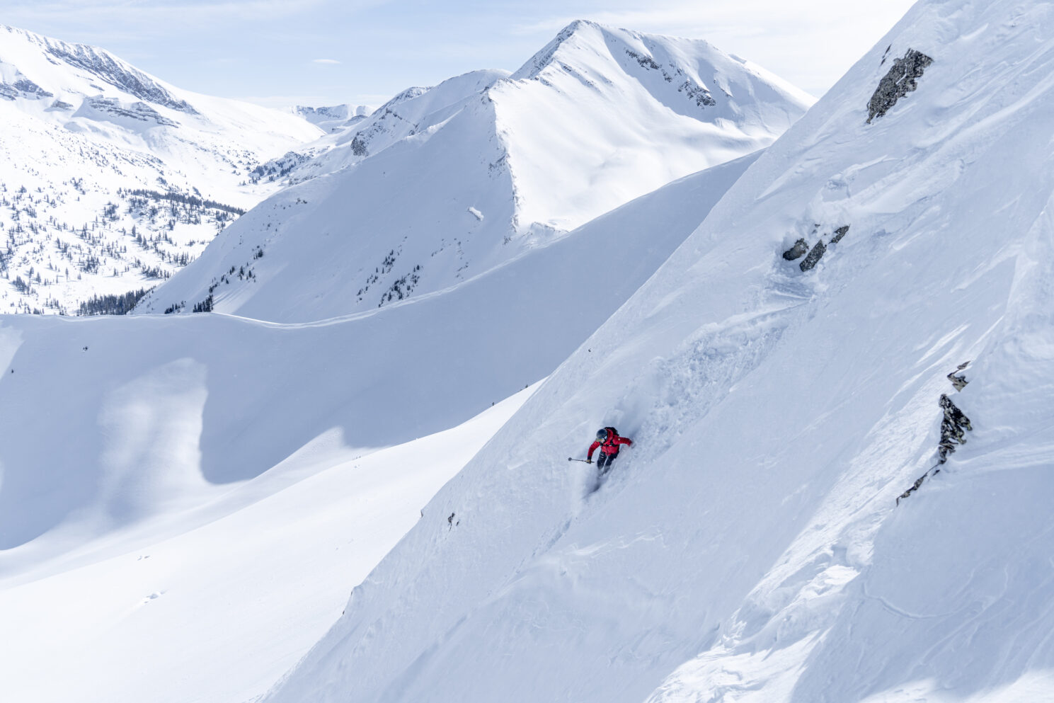
Figure 8: TJ David enjoying a prime 25-degree slope on a beautiful bluebird day in the Colorado Backcountry.
About the Author
Aidan Goldie-Ahumada
Location: Traditional lands of the Núu-agha-tʉvʉ-pʉ̱ (Ute) tribe in the Rocky Mountains
Top Gear Picks: HyperVector 177cm / Hyper V8 181cm
Instagram: @aidan.goldie
Born in Chile, Aidan (he/him/his) spent much of his childhood living in South America before immigrating to the United States where he lives today. In the latter half of his childhood, Aidan called the mountains of Colorado home and grew exploring his rugged backyard peaks through the lens of backcountry skiing and skyrunning. He is now settled in the Roaring Fork Valley where he works as a Physics teacher to best support his community through equitable and intentional education practices.
Aidan teaches, climbs, and backcountry skis on the traditional lands of the Núu-agha-tʉvʉ-pʉ̱ (Ute) tribe in the Rocky Mountains. When not teaching, Aidan feels most at home in cold winter environments with something sharp strapped to his feet. Whether it is a pair of skis or crampons, Aidan is on a continual search for aesthetic climbs and descents in our Rocky Mountains, continually shaping his mountain ethic to instill pedagogical values of environmental justice, equity, and cultural relevance.
Share this Post